Wednesday, May 31, 2006

Hot day in Chattanooga


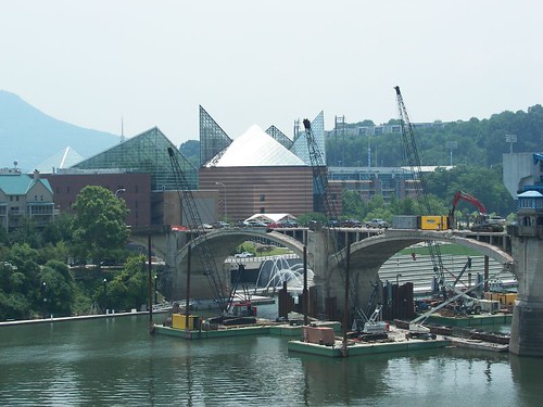
View of Riverwalk and Ross' Landing, Tennessee Aquarium and the Market Street Bridge, being renovated.


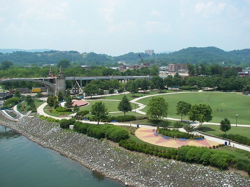
Across the river, Coolidge Park.


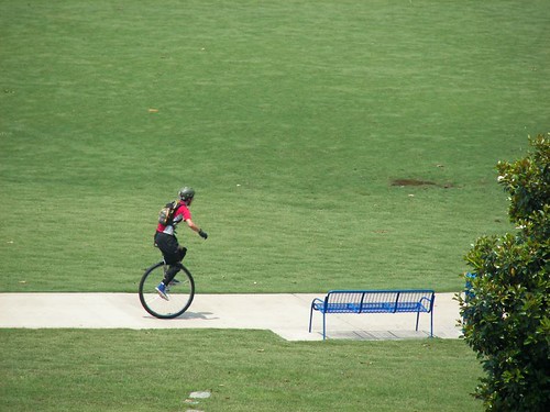
Unicyclist. Sorry I didn't catch the kid who was chasing him further back.


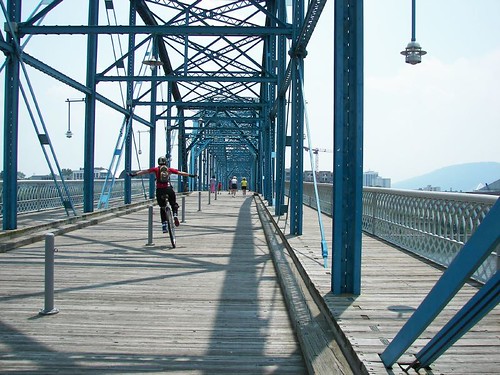
Same guy, slaloming across Walnut St. Bridge.


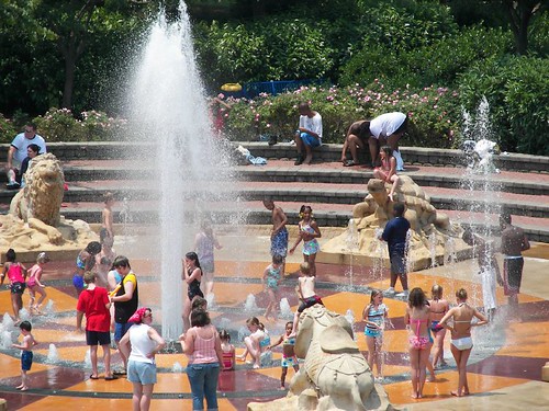
Taking advantage of the fountain.


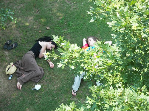
Taking advantage of the shade.

(Posted these photos from my Flickr collection, since Bloggerbot isn't working today. I may like this way better.)

Monday, May 29, 2006

On Hiwassee Lake. Posted by Picasa
Ribbon cutting near Murphy for new development (centered by an old-looking barn), Shoals at Glen AiriePosted by Picasa
Along Shoal Creek. Posted by Picasa
View from the barn. Posted by Picasa

Sunday, May 28, 2006

Cherohala ride

Along the Tellico River, on way up the Cherohala Skyway (from Tennessee to North Carolina); these photos from a ride on Wednesday. Posted by Picasa
Long distance views, on the way up to the highest point, where there were still no leaves on some trees at a mile high. Posted by Picasa
Transportation. Posted by Picasa
High forest with remnants of ancient chestnut trees. Posted by Picasa
Rhododendrons. Seems a bit early at this altitude (nearly a mile high)... Posted by Picasa
From the top, the road winds down to Robbinsville. Posted by Picasa
Nantahala River. Posted by Picasa
Dark and light. Posted by Picasa

Thursday, May 25, 2006

Roadside poppies. Posted by Picasa
Up close. Posted by Picasa

In Maggie Valley

A stop on Tuesday's ride at the Wheels Through Time museum; motorcycle and transportation history heaven.
Posted by Picasa
Owner Dale Walksler starting up one of the old ones. Posted by Picasa
This one runs too. Posted by Picasa
Out front, beautiful Maggie Valley. Posted by Picasa
Ready to ride. Posted by Picasa
Well, I remember 25c...many years after this was in operation.... Posted by Picasa

Wednesday, May 24, 2006

New header photo

This one is looking east toward Andrews, NC, from U.S. 19/74; this area was called Valleytown when it was a Cherokee settlement, along the Valley River which flows to Murphy and the Hiwassee River, 15 miles to the west.

On top of the Blue Ridge

Technically this is not the Blue Ridge. These photos are from a short ride on the Blue Ridge Parkway yesterday; the section from Pigeon Gap to Balsam. This part of the Parkway covers the much higher Pisgah and Balsam ridges: the Blue Ridge is to the South, in the distance in some of these photos, near the South Carolina and Georgia state lines.  Posted by Picasa


I have more photos from yesterday to post, especially from the Wheels Through Time museum in Maggie Valley, and some from today, from the Cherohala Skyway and along the way. Will get them in next day or so.

What can I say, it's just been a nice couple days for riding the mountain roads....

Spectacular color on the roadsides. Posted by Picasa